NASA SPACE APPS CHALLENGE 2026

THE EARTH ISNEVER STILL.

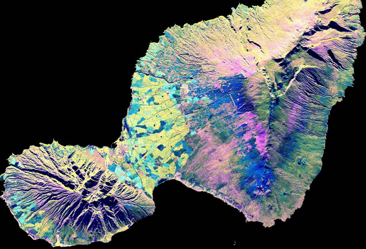
From shifting ground to rising waters and retreating ice. Discover how satellite radar reveals the changing landscapes of Peru.

EXPLORE THE CHALLENGE
SCROLL TO DISCOVER
02 / THE CHALLENGE

DANCINGWITH THE SARs

What if we could see how our planet changes, even through clouds and darkness?

The NASA Space Apps Challenge invites us to explore Earth's changing surface using Synthetic Aperture Radar observations from the NASA-ISRO NISAR mission.

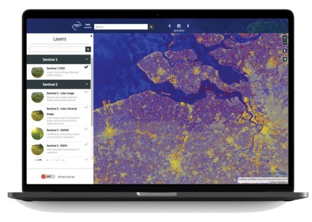
Our mission is to create an interactive application that tracks and visualizes changes in landscapes, water, vegetation, and other features of our planet.

DISCOVER THE STORY
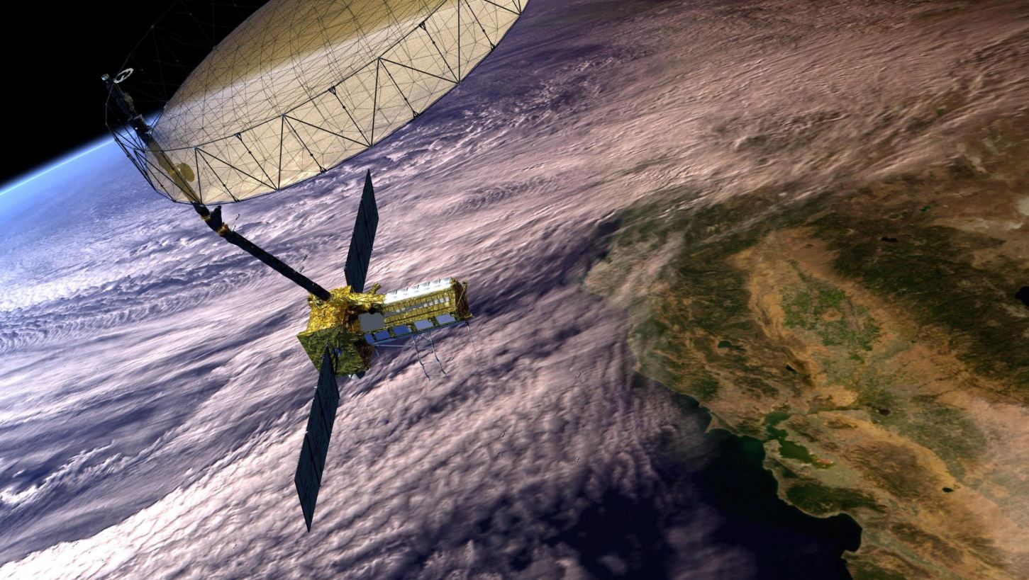
NASA-ISRO NISAR satellite orbiting Earth
NASA / ISRONISAR MISSIONSynthetic Aperture Radar

Illustration: NASA/JPL-Caltech

01

OBSERVE

Use NISAR radar observations.

02

ANALYZE

Identify changes on Earth's surface.

03

VISUALIZE

Make scientific information accessible.

RADAR SCAN • CONCEPTUAL VISUALIZATION
03 / THE STORY

A Land Shaped by Nature

Peru's landscapes are continuously shaped by natural forces. From destructive earthquakes to extraordinary coastal floods, understanding these changes is essential for protecting communities, infrastructure and ecosystems.

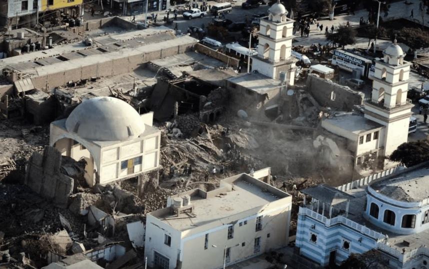
When the Ground Moved - Pisco, Ica, Peru
2007EARTHQUAKE
Historical image: Wikimedia CommonsVIEW SOURCE
2007

When the Ground Moved

On August 15, 2007, a powerful earthquake struck Peru's south-central coast. Beyond the immediate destruction, the event highlighted the importance of understanding ground deformation and seismic hazards.

WHY STUDYING THIS MATTERS

Studying ground deformation helps scientists investigate how faults move, improve earthquake models and provide additional information for infrastructure and risk assessment.
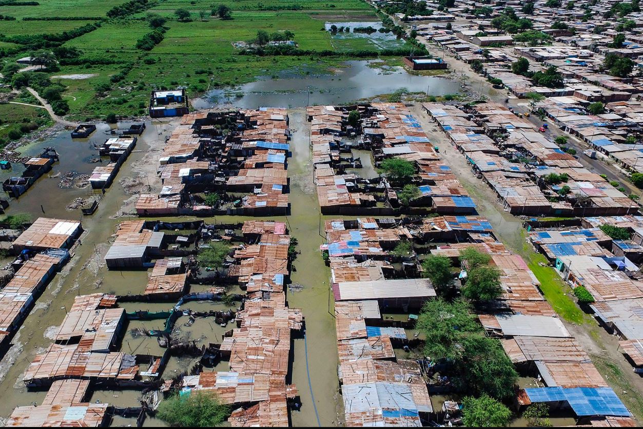
When Water Reshaped the Coast - Northern Coast, Peru
2017COASTAL EL NIÑO
Flood mapping: MAAPVIEW SOURCE
2017

When Water Reshaped the Coast

In 2017, unusual warming of coastal waters contributed to extreme rainfall and widespread flooding in northern Peru. Communities, agricultural lands, roads and river systems were severely affected.

WHY STUDYING THIS MATTERS

Mapping changes in water extent helps identify affected landscapes, document flood impacts and support planning for future extreme rainfall events.

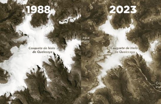
When the Ice Retreats - Quelccaya Ice Cap, Cusco, Peru
ONGOINGGLACIER CHANGE
Image: [add photographer or institution]VIEW SOURCE
ONGOING

When the Ice Retreats

In the high Andes of southern Peru, the Quelccaya Ice Cap is undergoing long-term changes. Its retreat highlights the vulnerability of tropical glaciers and the importance of monitoring mountain environments.

WHY STUDYING THIS MATTERS

Studying changes in glacier extent helps researchers understand tropical glacier retreat and provides valuable information for climate and water-resource studies.

FROM HISTORY TO SCIENCE

We cannot stop nature.But we can understand its changes.

By turning satellite observations into accessible information, we can better understand how natural forces transform Peru's landscapes.

EXPLORE THE PROBLEM
04 / THE PROBLEM

When Nature Changes the Land, Lives Change Too

Natural phenomena continuously reshape Peru's landscapes. Their consequences can be especially challenging for low-income and geographically vulnerable communities. Understanding where and how the land changes is an important step toward more accessible scientific information and informed disaster-risk assessment.

01

Coastal Flooding

Extreme rainfall and flooding associated with El Niño can affect homes, farmland, roads and local livelihoods.

02

Earthquake Deformation

Earthquakes can damage infrastructure and produce ground deformation that helps reveal seismic processes.

03

Glacier Retreat

Changes in Quelccaya's ice cover highlight the vulnerability of tropical glaciers and the importance of studying long-term environmental change.

05 / OUR SOLUTION

One Platform. Multiple Earth Changes.

Our goal is to develop an interactive platform that uses NISAR radar observations to explore changes across Peru, from coastal flooding to seismic ground deformation and glacier retreat.

01

El Niño and Coastal Change

Investigating changes in water extent and affected landscapes along the Peruvian coast during extreme rainfall events.

02

Earthquake Deformation

An ongoing investigation into the potential of satellite radar interferometry to detect seismic ground deformation in Peru. Reliable displacement estimation remains under development.

03

Quelccaya Ice Retreat

Monitoring changes in the Quelccaya Ice Cap to study glacier retreat and its implications for climate, water resources, and mountain ecosystems.

RESEARCH STATUS & FUTURE DEVELOPMENT

Scientific Progress, Open Challenges

We believe that transparent scientific research includes recognizing what remains uncertain.

Earthquake Ground Deformation

IN DEVELOPMENT

Our preliminary InSAR analysis faces an important challenge: atmospheric disturbances and other interferometric uncertainties can obscure the small displacement signals we aim to detect. Current results do not yet provide sufficient confidence to distinguish ground deformation from measurement uncertainty.

OUR NEXT STEPS
  • Acquire additional suitable radar observations.
  • Evaluate coherence and atmospheric phase delays.
  • Improve noise mitigation and phase processing.
  • Validate the methodology against independently documented seismic deformation.
06 / OUR IMPACT

Why Our Project Matters

Turning complex satellite observations into knowledge that people can explore, understand, and use.

Scientific Value
01WHY IT MATTERS

Scientific Value

Understanding environmental change through radar observations

Our platform highlights how satellite radar can reveal changes in coastlines, ground deformation, and glacier retreat while communicating the scientific meaning and limits of each observation.

Accessible Knowledge
02WHY IT MATTERS

Accessible Knowledge

Making complex data easier to explore

Instead of leaving satellite information inside technical reports, we transform it into interactive maps, visual comparisons, and intuitive explanations that a wider audience can understand.

Social Relevance
03WHY IT MATTERS

Social Relevance

Connecting Earth observation with real-world understanding

By helping people visualize environmental change, our project can support education, public awareness, and the identification of areas that deserve closer scientific attention.

From satellite observations to meaningful understanding — our goal is to make Earth's changes more visible, more accessible, and more relevant to people.

07 / EXPLORE OUR WORK

Ready to Discover?

Explore our application, video and scientific documentation.

Files and external project links will become available as the project develops.
08 / OUR TEAM

Supernatural Echo

Meet the six members of our NASA Space Apps Challenge team.

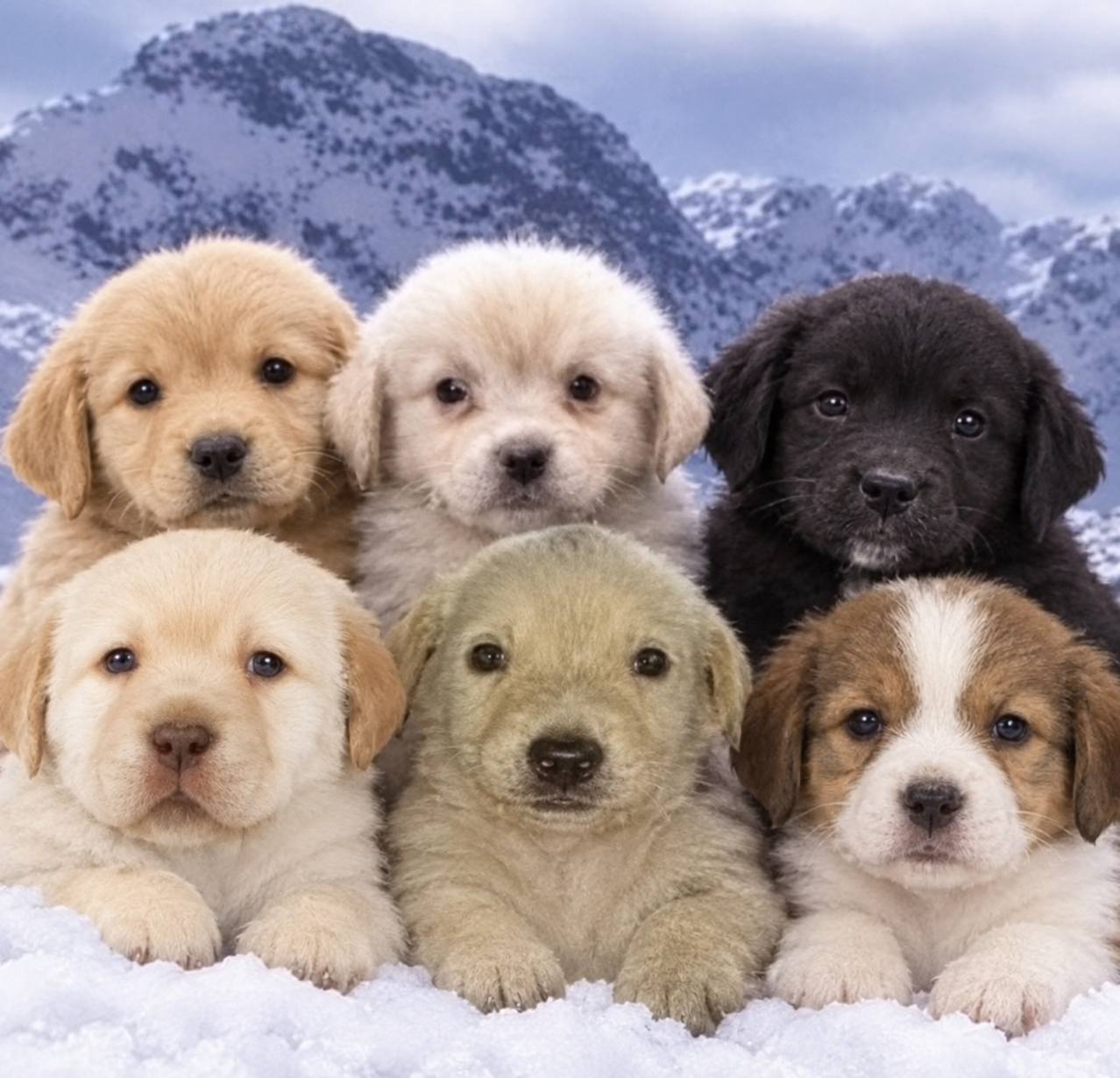
Supernatural Echo team puppies banner

Luis Antonio Heredia Bringas

Albert Joseph Vílchez Torres

Jarem Alexssander Villalobos Palomino

Arom Rey Ruiz Elías

Yostin Leonardo Quispe Grijalva

Daniel Tomás Córdova Juscamaíta